Subject: Re: ArmyJoe's Perpetual Picture Thread Sat Jun 14, 2014 3:48 pm
(Originally posted 07-13-2013)
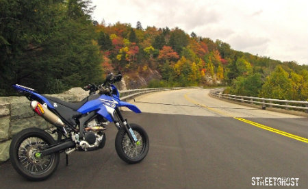
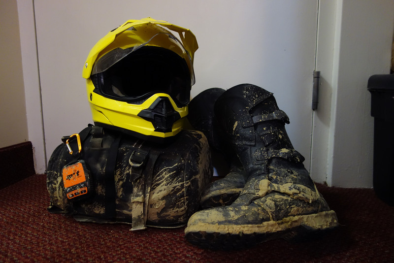
My new Alpinestars Scout WP boots arrived yesterday, so of course, I had to go break them in. There's so many old roads here, my quick trip turned into a 4 hour ride in an area about 4.25 miles in diameter.
This 180-degree panorama show four roads. The maintenance level varies from maintained, to overgrown, to "are you sure this is a road?"
It doesn't look like anyone has been down some of these roads in a while.
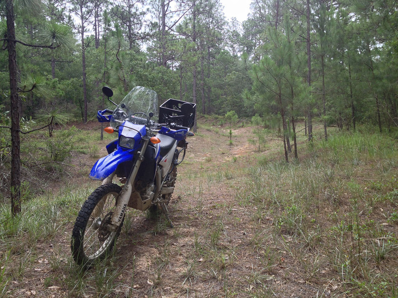
I'm not alone.
I discover an old recreation area, slowly being reclaimed by the forest.
Even with mud and the rain, my feet stayed dry. I love these boots! I can't wait to get back out.
Last edited by ArmyJoe on Sat Jun 14, 2014 3:52 pm; edited 1 time in total
ArmyJoe
Subject: Re: ArmyJoe's Perpetual Picture Thread Sat Jun 14, 2014 3:51 pm
(Originally posted 07-26-2013)
This video is a month old, but I finally had a chance to edit footage from my first AMA-sanctioned DS ride, the Long Cane Dual Sport, near Abbeville, South Carolina. It didn't go as smooth as I had hoped, but I survived, even if parts of my bike didn't.
From what I'm told, the route was tame by Ohio standards (not a single log crossing), but the first and last stages were slicker than snot. There's a reason potters refer to liquid clay as "slip."
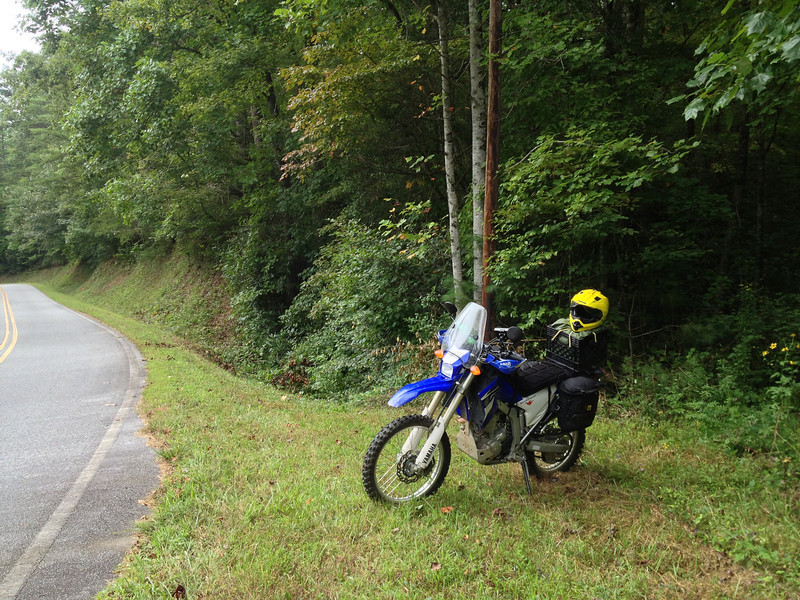
Towards the end, I was heading down a line of phone poles at a decent pace when I came upon a 90 degree left turn. As I came around, the bike started coming out from under me and I was heading for two trees. I managed to get the bike upright at the last minute and aimed for the space between them, but I was too wide.
To add insult to injury, the impact caused the handguards to lock my throttle and I went on a wild ride.
ArmyJoe
Subject: Re: ArmyJoe's Perpetual Picture Thread Sun Jun 15, 2014 11:59 am
(Originally posted 08-01-2013)
I'm slowly exploring the back roads and adding onto my adventure track. I'm up to 13 miles with very little overlap. While it may not be the best terrain, the fact that it's only a mile from my room is a big plus.
The best things about these old roads is that you never know what you're going to see around the next corner and that it changes from week to week. This is my first successful log crossing. It's slow, but ya gotta start somewhere.
ArmyJoe
Subject: Re: ArmyJoe's Perpetual Picture Thread Sun Jun 15, 2014 12:00 pm
(Originally posted 08-03-2013)
I took a break from studies and explored another area of Fort Gordon today. The GPS says 7 miles, but a lot of that is overlap. I'm hoping to add at least 4 or 5 to the 13-mile route I've already established.
While on the ride, I found a chimney in the middle of nowhere. I wonder how many families were displaced when the post was founded.
ArmyJoe
Subject: Re: ArmyJoe's Perpetual Picture Thread Sun Jun 15, 2014 12:01 pm
(Originally posted 08-27-2013)
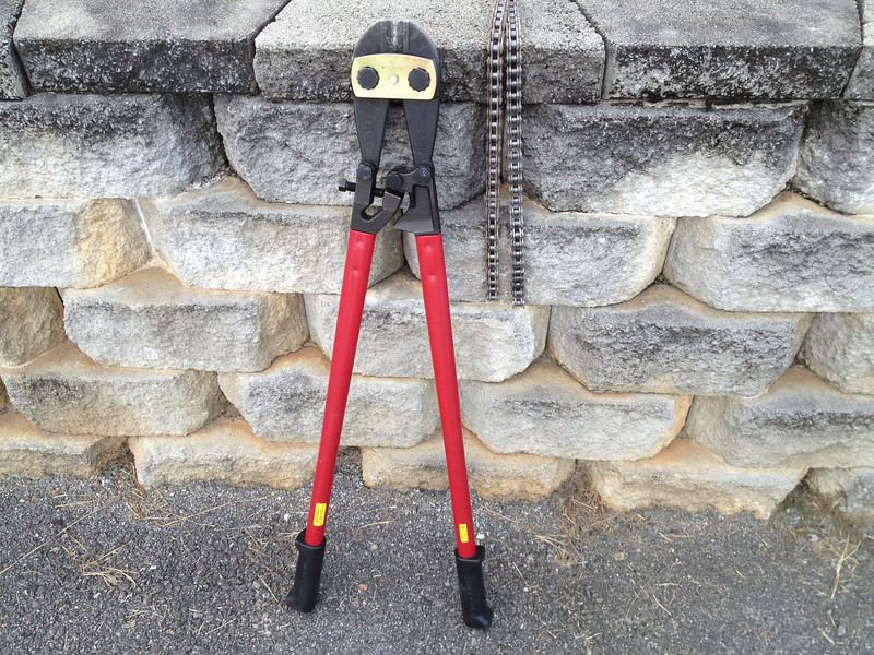
In preparation for the long weekend, I've been doing upgrades. The front end got a new D606. In the rear, we have a whole new drive system.
Not having a lot of tools, I was scratching my head to come up with a solution to get the OEM chain off. In a flash of inspiration, I went to the Company Supply Sergeant and signed out the 36" bolt cutters. After getting started, I found I needed a 27mm socket for the front sprocket. One trip to Sears and $30 later, I was back at it.
Like buttah
Glad a bought a new slider
Final product includes a 47-tooth rear.
While I had the bolt cutters, I also cut 1, 2, 3, and 4 link sections to keep for emergencies. I took it for a test ride and found that the on/off throttle snatchiness is gone. This is the way the bike should have came.
ArmyJoe
Subject: Re: ArmyJoe's Perpetual Picture Thread Sun Jun 15, 2014 12:06 pm
GTFO 2013 - Part Deux (Day 1 - Aug 30, 2013)
I woke up around 8 AM and packed a few last-minute things. On the spur of the moment, I imported an additional waypoint into my GPS, which I later found would have a big impact on the trip. After a quick stop at Burger King for breakfast, I was on the road about 10 AM.
About an hour into my trip, I stopped to check my tracks on Spotwalla and was surprised to find I didn't have any. I sent an "OK" message to see if that would jump start the process and continued traveling. An hour later, I stopped again, but still didn't see any tracks. At that point I realized I had to press a button to enable tracking. D'oh! So when you look at the map, that's why tracking doesn't start until I'm 100 miles from the start.
Since this will probably be my last big trip in Georgia, I wanted to check out a few historical sites. The first would be Camp Toccoa, where WWII Parachute Infantry Regiments trained, including Easy Company of the Band of Brothers miniseries. There's not much there expect for one block building and an empty field, but here's the memorial at the site:
From there, I took a three mile ride up to the top of Currahee Mountain. The actual peak is covered by communications antennas, but the secondary peak offered an impressive view.
Heading down the mountain, I rode into the town of Toccoa for gas and saw this huge mural.
After gassing up, I discovered my GPS mistake. When you import data into the GPS, it overwrites the previous import file. So here I was two hours from my start and I had no tracks, routes, or waypoints from my previous TET / Southern DS Loop trip. I could get by without the tracks and routes, but without waypoints, I had no idea where all the camp grounds were. Oh well, no use worrying about it now. Worse case scenario is that I'll have to stealth camp somewhere.
From Toccoa, I headed to Black Mountain Road and saw a welcoming sign.
After completing that, I zig-zagged through Georgia and South Carolina, hitting some fun paved roads, like SC-28 above Wallhalla. A short jog west would bring me to more gravel on Hale Ridge Road in the Chattahoochee National Forest. About half-way through, I come across three horse riders. The obviously heard me coming, because they were waiting for me in the middle of the road and waved for me to stop. The lead rider, whose diction was worse than Gabby Johnson in Blazing Saddles, was trying to warn me of something. Trying not to be rude, I turned off my engine and asked him to repeat himself. The second time around he was almost as indecipherable, but I managed to hear the word "wagons." I nodded my head in acknowledgement and waited on the side of the road. After 10-20 seconds, I see this come around the bend.
Arriving in Dillard, Georgia, I start looking for a place to eat dinner. I tried Tomlin's BBQ in Rabun Gap, but they were closed. Heading back up the road, I saw Scooters BBQ and pulled in. I had the beef brisket. I thought it tasted good, especially with their sauce, but the meat appeared to be cut with a deli slicer, which gave it a "processed" look.
Getting back on the road, I headed into the grounds of the Coweeta Hydrologic Laboratory. The sign at the entrance said there was no camping, but a map at the visitor kiosk mentioned Standing Indian Campgound just outside the Lab's boundary. It was after 7 PM by then, so I made it my goal for the evening.
Wow, all of sudden I have to pee really badly.
I head over the mountain to begin the 14-mile trip to Standing Indian. Along the way I pass the Hurricane Creek Primitive Camp and I'm shocked to see RVs set up in there. I'm thinking there's no way I'm going to find camping at 8 PM on Labor Day weekend, so I start scouting for sites along the way where I can potentially hole up. I found three really good spots with fire rings showing previous occupation and marked them on my GPS in case I had to backtrack. I get to Standing Indian and the camp store was closed, but was lucky enough to catch the wife / manager as she was walking her dog. She said there were only 3 spots left in the camp: Two tent sites and one RV site. She give me the site numbers, I thank her, and head down the road as fast as I can without raising the ire of the other campers.
The two tent sites were still available, one on the inside of the loop and one on the outside. I chose the one on the inside as the mountain laurel formed a natural screen from the other campsites. I quickly set up my tent and then went back to the camp store to register and pay my $16. I only had a twenty, but I was again lucky when the husband / manager stopped by and was able to make change. From there, I made a 10-minute stop in a clearing to get a SPOT message off to my wife, letting her know I'd stopped for the evening. When I was confident the message had been sent, I went back to the tent, grabbed my toiletries and some clean clothes, and headed down to the shower house. In reckless abandon, I wore flip flops and no reflective belt (let's see who understands that reference).
Examining my GPS I see I had 241 miles for the day.
Nice start to the weekend. Tomorrow I have a decision to make: east or west.
ArmyJoe
Subject: Re: ArmyJoe's Perpetual Picture Thread Sun Jun 15, 2014 12:11 pm
GTFO 2013 - Part Deux (Day 2 - Aug 31, 2013)
My minimalist camping style caused some trouble. My tent is forest green and I parked the bike behind the tent in case I wanted power for my electronics. As a result, I had a very small footprint and cars pulled into my campsite all night long. Most had the decency to turn off their headlights, but several times I woke to an illuminated tent, mild cursing, and slamming car doors, as campers looked in vain for an empty spot.
As a result, I slept until 9 AM, ate some Lara Bars and dried fruit for breakfast, and rolled out about 10 AM.
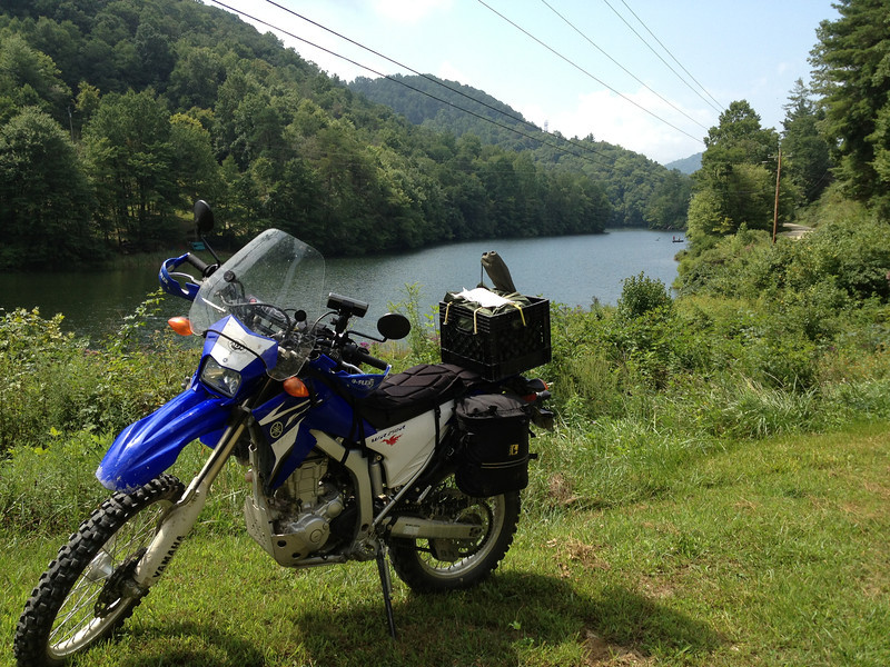
I'm really loving the milk crate and Army waterproof bag combo. It's the perfect size for my sleeping bag, air mattress, and tent.
I stopped by the camp store to check out, buy some Mountain Dew, and help direct new arrivals to the campsite I just left.
I made my way towards Andrews, NC. At times, the trail looked dark and foreboding.
Queens Creek Lake alongside Winding Stairs Road.
It was about 1 PM when I pulled into Andrews. I rode through downtown looking for a restaurant, but nothing caught my eye. I stopped a passing 20-ish local and asked for a recommendation for a place to eat. He replied, "We have a Huddle House and McDonalds down the street." I don't know if he could see my vacant expression through the helmet, but he then added, "We had a steak place, but it closed." I thanked him and headed west on Main Street. Towards the end of town, I passed a strip mall with a restaurant at one end. There was a dozen cars out front, so I took that as a good sign. I parked in front of Loafers Pizza and Sports Bar and went in.
I could tell by the menu that pizza and calzones were their main draw, but I didn't want to wait 15-20 minutes for it to bake. I ordered a meatball sub, which turned out really good. I was pleasantly full and got out for under $10.
I walked outside just as thunder rolled in the distance. I rode down the street and got gas as I waited out the cell.
From there I rode up Beaver Creek Road, over the Porterfield Gap, and down Little Snowbird Road.
With some other minor roads thrown in, I managed to string together a route that was 28 miles long, mostly dirt, and deposited me less than 2 miles from the Cherohala Skyway.
Go home, bear. You're drunk!
From here I had to decide which way I wanted to go. West towards Tellico Plains and unknown camping potential? Or east towards Kickstand Lodge and guaranteed camping?
Kickstand Lodge it is! I got there around 4 PM and set up my tent in the daylight for the first time. After getting settled in, I wandered over to the main house to grab a beer and socialize. As I sat in an Adirondack chair, I stared at the stuff on the ceiling and wondered the story behind each item. I really need to get some Ohio ADV stickers so I can add to the collection.
The GPS only indicated 117 miles for the day, but I didn't care. It was good to take a mental health break and be away from the Army for the weekend.
Tomorrow I make a huge tactical error.
ArmyJoe
Subject: Re: ArmyJoe's Perpetual Picture Thread Sun Jun 15, 2014 12:14 pm
GTFO 2013 - Part Deux (Day 3 - Sep 1, 2013)
I woke to heavy rain around 6 AM. Checking the weather radar, it looked like it was going to rain for a while, so I set my alarm for 9 and went back to sleep. When I woke up the second time, the rain had stopped, so I went to see if there was anything to eat. While Mo provides dinner, breakfast is usually cooked by the guests. In this case, breakfast was in progress and I had some delicious banana pancakes and ham slices. Checking the sky, there was intermittent patches of blue, but the radar showed incoming rain.
When I'm traveling with the family, this is what we'd call a "museum day." With that, I decided to go to Wheels Through Time in Maggie Valley.
I'll be the first to admit I'm not a Harley fan. If I wanted to be part of a culture based on marketing, I would have joined the Marine Corps. Nevertheless, I knew they had some WWII-era bikes and that's what I really wanted to see. Walking in the front door, you're treated to a hill climber and the belly tanker discovered by the guys at American Pickers.
I paid my $10 (yay, military discount!) and headed inside. Even though I had no idea what I was looking at, I was impressed my the size of the collection and the time (and money) it must have taken to accumulate it. One of the really cool things about this place is many bikes are not restored and can even start.
Of course, bikes that were ADV-worthy caught my eye.
And the 1915 bike from the Dayton. Go, Bucks!
And the pin-up girl.
And what kid raised in the 70's wouldn't be impressed by Evel Knievel's bike.
I really loved the OD Green on the old Harleys.
But that only reminded me why I was here. Bring on the military hardware!
The 1942 Indian 841
The 1942 Harley Davidson XA.
Harley Davidson TA Trike, serial number 1 (of 17).
And my dream bike, the 1942 Harley Davidson WLA.
By now it was about 1:30 PM, so I went up the block to Maggie Valley Restaurant for lunch. I asked the waitress to recommend something. I've never had trout before, so that made my choice easy. It was delicious and not at all "fishy."
By now it was getting to be mid-afternoon. I tried checking the weather radar, but my app wasn't loading the graphics. With a little time to kill, I decided to take the long way back to camp by going a 120 mile route over Clingman's Dome, through Cades Cove, down Parson Branch Road, and down the Dragon to NC-28. Big mistake!
After heading west through Maggie Valley, I jumped on the Blue Ridge Parkway to bypass Cherokee.
On the north side of Cherokee, I stopped for gas and waited out a small rainstorm. I tried to check my weather radar app, but it still wasn't working. I headed north to Clingman's Dome and only got 2 miles before the skies opened up. I was just passing the Oconaluftee Visitor Center, so I rode across the grass on the right median, parked in their lot, and ran for cover. I got there first, but other riders quickly joined me.
After waiting for the rain to stop, I jumped back on the bike and headed up. The ride to Clingman's Dome wasn't too bad and I made pretty good time. By now it was after 5 PM and pretty cloudy, so I didn't bother making the walk up the hill to the observation tower. I only hung out long enough to take a few pictures.
The road heading back down US-441 towards Gatlinburg was really cool, but the traffic was slow. I would have loved to take the 405-degree turn at a decent speed, but the continuous line of cars were only doing about 20 MPH. When I finally turned onto Little River Road, it was after 6 PM. With 60 miles to go, I was starting to get worried.
With most of the traffic heading out, I hauled ass on the 25-mile entrance to the park. However, once I got to Cades Cove, I found out why people say to avoid it. The area is a geologic curiosity, being a 2-mile by 7-mile isolated valley in the middle of the Great Smoky Mountains. And to the horror of those trapped inside it, it has a 11-mile one-way loop running around the perimeter.
Things were going great for the first 2.5 miles, but then I hit traffic. And we didn't move. For 10 minutes. I got pissed and started to pass people on the left. That went well for all of 10 cars until someone started screaming at me. Not wanting to get into a road rage incident, I got off and walked the bike. I even took off my helmet to emphasize the "not riding" part. On flats and uphill, I put it in gear and let the idle speed and 47-tooth rear do its thing. Downhill I cut the engine, put it in neutral, and coasted down standing on one peg. As opposed to my first interaction with the public, all my subsequent comments were of the "Good idea!" and "You lucky bastard" variety.
After a mile of walking, I finally got to reason for the jam. There was a bear in a tree on the side of the road and drivers had stopped their cars on the road to get out and take pictures. As I passed the first car, I said in a very loud voice, "You caused a one-mile backup for a damn bear in a tree?" Nobody bothered to reply or head back to their cars.
A little further down the road, I stopped long enough for one picture.
And a few minutes later, I was heading down a dirt road to Parson Branch Road.
Everyone raves about Parson Branch Road. It's 8 miles long! It's one-way! It's got 18 water crossings! Let me tell you, the road sucked and was not worth the price of admission. All the water crossings are paved and four were dry. Of the ones that had water, I didn't even get my feet wet.
I guess to someone on a big-bike, this is high adventure. But I have enough time in the saddle to know there's a lot better out there. The only thing I could say was a positive was the one-way traffic, so I could be reasonably sure I could haul ass without running head-on into someone else.
Reaching the Dragon, I turned south and headed for camp. By now it was after 8 PM and the road was deserted. No cars in sight and better yet, no cops. I rode as fast as my talent would allow and crossed into North Carolina just as my GPS switched to dim mode, indicating it was past sunset.
From the Deal's Gap Motorcycle Resort, I had a 22-mile ride in dark, wet, and foggy conditions. I took it slow and only had to pull over for one car that obviously knew the road better than I did. I pulled into Kickstand Lodge around 9 PM, just as dinner was finishing up. I jumped off my bike and loaded up my plate. Several guests gave me shit for the timing, jealously mocking for riding all day and then arriving when dinner was on the table.
The GPS indicated 184 miles for the day and clearly showed the climb and descent of the tallest peak in the park.
Tomorrow I head home and take the road less traveled.
ArmyJoe
Subject: Re: ArmyJoe's Perpetual Picture Thread Sun Jun 15, 2014 12:23 pm
GTFO 2013 - Part Deux (Day 3 - Sep 1, 2013)
I woke about around 8 AM and make a quick run into Robbinsville for cash. Heading back to camp, the Great Smoky Mountains were doing their thing.
After a quick breakfast of scrambled eggs and potatoes, I settled my tab and packed up to leave.
I wasn't in a rush to get back to Ft Gordon, but I didn't want to linger, either. I had to get back in time to eat dinner and do some laundry, so I was shooting for a 6 PM arrival time. With the WR250R being a dual sport, I didn't want to miss out on some of the better paved roads in the area, so I headed south on NC-28. This route is also known as Hellbender 28 or Moonshiner 28, depending on whose marketing you subscribe to. No matter what you call it, the route offers great twisties with higher speeds than the Dragon.
From Franklin, it was a straight shot down US-23 to Dillard, Georgia, and from there I headed east. I went south on Hale Ridge Road, going back the way I came, but half-way through, I decided to do some exploring. The Chattooga River District motor vehicle use map, says my route took me from Forest Road 7, to FR 86, to FR 86C. The last one was best of all. It was rocky, muddy, overgrown, and twisty.
It even had a log crossing.
At one intersection, I found an unmarked road and an abandoned road branching off from the main route. I followed the unmarked road for a short bit, but turned around when I found it was leading me away from my destination. I went back to the intersection and parked the bike to check out the abandoned road, which the GPS said was Totter Pole Road. Two large piles of dirt would keep out any 4-wheel vehicle, but there was a definite path for foot or 2-wheeled traffic. Once I was past the mounds, I could tell by the steep sides that this was once a well-used road. It reminded me of wagon roads that I would find along the ridgelines while backpacking the National Forests in Ohio.
The road was fairly overgrown with a few down trees. The larger ones could be bypassed or rode over. Not all of them successfully.
Towards the end, the road curved right on the GPS, but it really continued straight down. Just as I was about to break out onto Warwoman Road, I was stopped by a HUGE tree across the path.
I parked the bike and scouted for a bypass, but it was no use. There were two small creeks on either side of the road and their banks were too steep. Not wanting to backtrack, I laid the bike on its side and dragged it under by the front tire.
After five minutes of pulling and ten minutes of rest, I was back in business.
Like my previous trip, I'm glad the toughest part came at the end to serve as a finale and high point of the trip. Jumping back on NC-28, I headed south until I passed a sign for Low Water Bridge Road. I turned around I went to check it out and found a small camping area with what was probably a ford, which is now used as a put-in for light watercraft.
Coming down out of the mountains, the landscape was dotted with small meadows.
Before long, I was back in Toccoa. From here it was pretty much a straight shot back to Fort Gordon, but I had one more side trip to do. About 9 miles north of Elberton, Georgia, the self-proclaimed "Granite Capital of the World," is the Georgia Guidestones.
Nobody knows for sure who put them here or why. Their origin and purpose have been debated by everyone from New Age hippies, to conspiracy theorists, to bible thumpers. These huge granite slabs are known for their 10 guides written in eight languages. In English, the ten guides are:
1.Maintain humanity under 500,000,000 in perpetual balance with nature. 2.Guide reproduction wisely — improving fitness and diversity. 3.Unite humanity with a living new language. 4.Rule passion — faith — tradition — and all things with tempered reason. 5.Protect people and nations with fair laws and just courts. 6.Let all nations rule internally resolving external disputes in a world court. 7.Avoid petty laws and useless officials. 8.Balance personal rights with social duties. 9.Prize truth — beauty — love — seeking harmony with the infinite. 10.Be not a cancer on the earth — Leave room for nature — Leave room for nature.
In addition to the Guidestones themselves, there's an explanatory tablet and what can be described as a historical marker.
It was 4:30 PM by now, so it was time to haul ass. I found the new gearing not to be much of a problem on the highway. I got back to Ft. Gordon around 6:15 PM with just under 811 miles for the weekend.
Great way to wrap up the summer. I still have one more 4-day weekend for Columbus Day. The weather will be cooler then, so maybe I should head south. For now, it's...
MISSION COMPLETE.
ArmyJoe
Subject: Re: ArmyJoe's Perpetual Picture Thread Sun Jun 15, 2014 12:30 pm
(Originally posted 10-06-2013)
This is my last free weekend at Ft. Gordon. I had hoped to head back to the mountains, but it looked like the weather wasn't going to cooperate. So instead, I stayed local and checked out the gravel across the border in South Carolina. I did my best to make a route based on an old screen shot I saw in the local ADV thread. My GPS tracks can be found here.
The weather was perfect for riding.
I found a few creek crossings, too.
I stopped to check out "Rock House," built in the early 1800s and said to be haunted.
I ran over this guy. He must be part honey badger, because he didn't care.
I arrived in Abbeville, South Carolina about 4:30 PM, thirty minutes before Rough House was about to re-open for dinner.
I took the time to wander around the town square.
The Courthouse.
The Opera House / Municipal Building.
The Belmont Hotel.
The interior of Rough House.
Their specialty is hot dogs, so I had three with chili and onions, with a side of conversation. In talking with the server, I learned that Abbeville used to be a stop-over point for train travel and the hotel and opera house were the lifeblood of the town. Like many other small towns, there's not much here and a few shuttered business stand testament to the difficulty in staying afloat.
There's a lot to explore in this old town, but I had to be heading back. Taking off about 5:15 PM, I didn't bother rushing because I knew I'd never make it back before dark.
Doing the last few miles of gravel in the dark was a new experience and added a bit of challenge to the ride. It's definitely something I'd like to do again.
I had just under 200 miles for the day. It was a great way to close this chapter and prepare for the journey home.
ArmyJoe
Subject: Re: ArmyJoe's Perpetual Picture Thread Sun Jun 15, 2014 12:33 pm
(Originally posted 12-29-2013, back in Ohio)
Highlights from yesterday's ride, where it was 50 degrees and sunny. 192 miles for the day. These are the GPS tracks from Knox, Holmes, and Coshocton Counties.
Meeting for lunch in Millersburg, Ohio. Left to right: ArmyJoe, MeefZah, Somecallmetim, Firedog45, Jon, Rich_B, alansz400. Photo by MeefZah.
alansz400 and ArmyJoe near the flooded south end of County / Township Road 366. Out there is State Route 715 (Walhonding Road) and the confluence of the Walhonding and Kokosing Rivers.
GoPro helmet cam video.
ArmyJoe
Subject: Re: ArmyJoe's Perpetual Picture Thread Sun Jun 15, 2014 12:38 pm
That's about brings it up to date. Since mid-March, I've been "deployed" to the Dominican Republic, but I'll be home in a few weeks. I'll try to keep this thread updated from here on out. I hope you enjoyed the stories and photos.